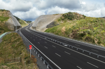
The NZ Transport Agency has released a new animation showing how the Western Ring Route will make it easier to travel through and around Auckland and the upper North Island.
The 90-second video at https://youtu.be/mm-TMe3Qb2E, details the work already completed and currently underway to complete the Western Ring Route, a 48km motorway which will help traffic flow better, reduce congestion on local roads and link Manukau, the central city, West Auckland and the North Shore.
“The Western Ring Route is an additional route to State Highway 1, providing better connections and giving motorists the choice to bypass the central city,” says the Transport Agency’s Auckland highway manager Brett Gliddon.
“The animation also shows the improved links to the airport as well as new shared paths to make it easier and safer for cyclists and pedestrians.”
The release of the video coincides with the official celebration of the completion of the Causeway Upgrade project, which is a key component of the Western Ring Route.
Transport Minister Simon Bridges marked the official opening of the project which has widened and raised a 4.8km section of the Northwestern Motorway between Te Atatu and Great North Road.
“Extra traffic lanes as well as dedicated bus shoulder lanes and improvements to the cycleway will make the Auckland road network safer and more resilient, improving travel times and making everyone’s journey more predictable, whether you travel by car, bus or by walking and cycling.”
Another key component in the Western Ring Route, the Waterview Connection, is due to open next year. The Western Ring Route is one of the government’s Roads of National Significance because of its benefits to New Zealand’s economy.


